BIG WATERSHED PROJECTS-Recharge water to the aquifer
All dams and spreading grounds in the watershed are targeted for improvements that would generate a meaningful increase in the total volume of stormwater recharged to groundwater. Big Tujunga Dam would be structurally rehabilitated to provide significantly enhanced storage capacity, such as dredging away the silt to make it deeper, improved downstream flood protection and a modified flow release regime designed to support wildlife & their habitats. Hansen Dam would be managed to enhance storage capacity through removal of sediment and implementation of operational changes. Pacoima Reservoir would generate additional storage capacity through removal of accumulated sediment. All these changes at the dams significantly increase the amount of water available for groundwater recharge through the spreading grounds. Spreading grounds themselves would be optimized through modernization and automation of intake structures, reconfiguration of spreading basins, and installation of rubber dams and vertical trench drains.
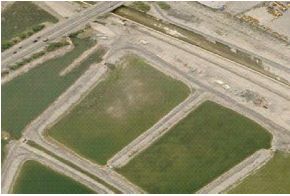
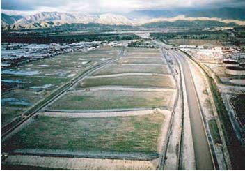
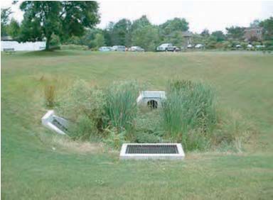
Spreading Grounds (Photos from The River Project)
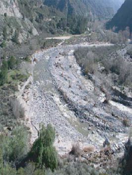
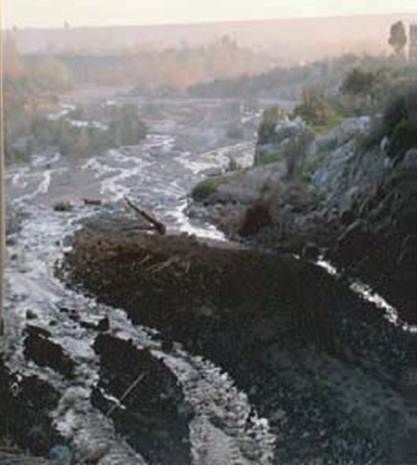
Wild & scenic Big Tujunga Creek before some of the water is put into a concrete channel
and eventually ends up in the ocean. Because we might not be able to rely
on our imported water, we need to use our local water wisely.
(Photo from the river project)
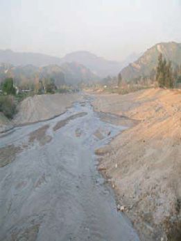 Wild & scenic Little Tujunga Creek north of Foothill. This is a picture of a creek
before some of the water goes into the cement channels and out to the ocean.
Below you will see on the right side of the picture the Tujunga wash which is well contained in concrete
but before that the water came from places like the river in this picture.
(Photo from The River Project website.)
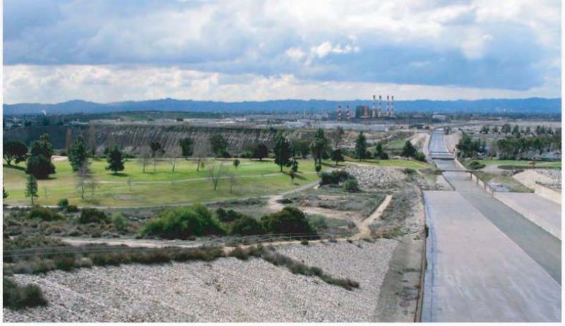
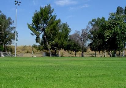
View from Hansen Dam:
Tujunga Wash (channel to the right), Sheldon Pit (space after green golf course)
There are abandoned surface mining pits that aren’t used anymore. One idea is to use these pits, such as Sheldon Pit, for ground water retention. In a year when there is a large amount of rain this pit & others can be used as places to store the extra water, instead of letting the water flow into the ocean because there isn’t enough extra space. Besides extra water holding capacity, there can also be diversion of water from the Tujunga Wash to Sheldon Pit for groundwater recharge & wetlands quality enhancement. It should Increases local water supply by 2,000 acre-feet per year, improve water quality, This project would satisfy more than one objective. Los Angeles County Flood Control District is working on this project.
(Photo from The River Project)
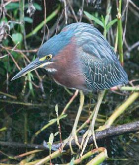
NPS photo, most projects are trying to retain water for the aquifers but they
also want to encourage wildlife, like this green heron, to use these places.
(NPS Photo for The River Project.)
Little Tujunga Creek passes beneath the 210 Fwy; it shows the large amount of
water that can come down from the mountains when it rains & snows. The intention is
to capture this water to put in the underground aquifers.
(Photo from The River Project.)
PARKS-Recharge water to the aquifer
These projects run under the assumption that it is better to collect water where it falls instead of dealing with polluted runoff or sending the water into our waterways and then unused out to the ocean.
Our main watershed in the Valley is named the Pacoima/Tujunga watershed. An organization named The River Project (TRP) got a grant to investigate what were our prospects of relying more on local water and especially from this watershed. Their study revealed that our chances were very good if both the governments and the residents, especially in the watershed areas, got serious about retaining more good quality water. The TRP then asked for all kinds of groups in the Pacoima/Tujunga Watershed to put in requests for projects that would eventually save water in their communities. They received about 200 applications from entities as large as the DWP to help with dams & spreading grounds and also requests from smaller groups like Neighborhood Councils for small pocket parks that would retain water. From the 200 they picked 37 preferred projects; most of these projects were different from each other and they varied in size.
Below you will see a picture of one of those projects that “The River Project” just finished for a greenway along the Tujunga Wash. They are just breaking ground on a project along Woodman Ave., in Panorama City where they will dig up a median in the middle of the street and configure it in such a way so that it retains more water when it rains. They will be replacing 85 older trees with 100 new native ones and all sorts of native plants will be included. Another project that came out of their study is one to help homeowners in Panorama City retain water on their properties with the use of such techniques as digging swales, French drains, porous driveways & walkways. If you want to see pictures and descriptions of all the 37 preferred projects you can click here http://www.theriverproject.org/tujungawash/plan.html . Choose Chapter 4 Projects.
Click here to get to their Home Page because The River Project is working on other things, also. The San Fernando Valley Sierra Club Group has a writeup about “The River Project” You can see pictures of the fun pocket park they developed in Studio City beside the L.A. River.
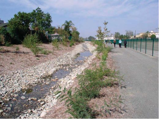
This stream was made to divert water from the Tujunga Wash.
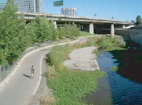
The River Project says, “In the time between the inception of the planning process and its completion, one watershed-based project was completed and three others are underway. Along the Tujunga Wash between Vanowen Avenue and Oxnard Boulevard, a mile-long project completes the first phase of the Tujunga Wash Greenway, and includes a meandering stream, walking paths, native landscaping, interpretive displays, benches, and a shaded picnic area (See photo above).The project takes urban runoff from the Tujunga Wash channel that was routed to the underground stormdrain system feeding the Los Angeles River, and diverts it through a gravity-fed pipe to the project site. The runoff then feeds a recreated streambed alongside the concrete Tujunga Wash channel where it is infiltrated to groundwater rather than being lost to the ocean. Native plants in the streambed help clean the water, and establish habitat for animals such as birds, frogs, and lizards. During a year with average rainfall, as much as 325,000 gallons of water per day will flow through the streambed and will produce enough groundwater recharge to provide 760 families of four with drinking water for an entire year. .” This recreational and ecological amenity can be replicated in neighborhoods throughout the 500 miles of open flood control channels in the County of Los Angeles. For now, in the summer the stream bed is dry but it will come to life when we have rain. The park is located on the east and west sides of the Tujunga Wash between Vanowen Ave. and Oxnard Bl. Park entrances are at Vanowen Ave. and Fulton Ave., Victory Bl. and Ethel Ave., and Oxnard Bl. and Coldwater Canyon Ave. Shaded picnic tables are provided in the grassy area near the northwest corner of Oxnard Bl. and Coldwater Canyon Ave.
Related to the L.A. River Revitalization Master Plan, the project would create a green
network of parks, bikeways and open space for the communities along the L.A. River,
adding recreational space to the urban areas of Los Angeles and effectively
managing stormwater runoff. This is located on Moorpark St. where it is near the L.A. River.
(Photo from River Project website)
Great things are not done by impulse, but by a series of small things brought together.
—Vincent van Gogh
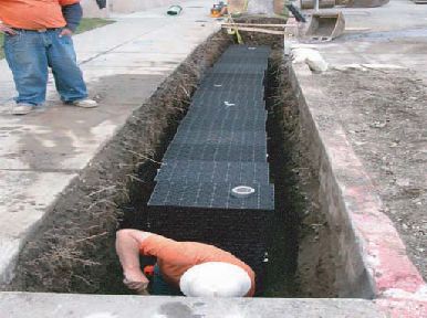
These are black boxes with many holes in them and the boxes can be built to any
size depending on the need. Stormwater seeps into theses boxes and leaks out in a controlled way
to capture stormwater and grey water which will end up in the aquifer. See the concept below:
(Photo from River Project website)
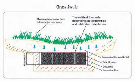
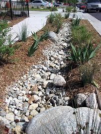
The grass swale is a dip to encourage water to flow into a depression. Then it flows into
these holey boxes and is captured but slowly seeps out into the aquifer.
(Photo from River Project website)
Van Nuys Blvd. pocket parks
Plans to develop neighborhood parks with native plantings & swale network
into a water retention basin in Panorama City on vacant land.
(Photo from River Project website)
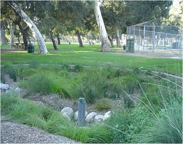
Sun Valley Park with ground water recharge underground Bioswale for catching rain water
(Photos from River Project website)
This is Sun Valley Park, which is in the Tujunga Watershed Area. This is a park that was redone so it will catch excess rainwater from the surrounding community. The Sun Valley area has a history of flooding. The project helps with flooding, will provide reduced stormwater pollution and it will increase groundwater supply. The project will accomplish these objectives by collecting the tributary stormwater flows upstream of the park through a system of catch basins and storm drains. The water will then be carried to underground treatment units, which will extract larger particles of sediment along with oil and grease. Low flows, which are the most polluted, will be further treated by a heavy metals treatment device. The treated stormwater will then be conveyed to two underground infiltration basins, from which it will percolate into the ground, eventually recharging the depleting groundwater supply. Since the entire system is underground, the surface of the park will remain relatively undisturbed.1`
Using power line easements for groundwater recharge & flood protection. There
will be opportunities for pocket parks, recreation areas and trails linking large
portions of the watershed. It would enhance 500 to 1,000 acres of land for public access, open space,
habitat and recreation. The project would increase local water supply by more than 170 acre-feet per year,
per quarter mile; potential for as much as 7,000 acre-feet per year. DWP is working on an initial
pilot project along this easement. TRP proposes implementation along all transmission easements
once DWPs pilot has been implemented and monitored.
(Photo from River Project website)
Parks, trails & ground water recharge along power line grid.
Demonstration of Ground Water Techniques
(these photos from River Project Website)
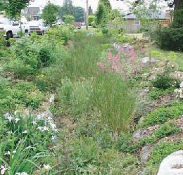
These are swales. They are depressions in the ground
to lead water underground instead of on the street.
They can be put in yards, parks or street medians to collect rain.
(Photos The River Project)
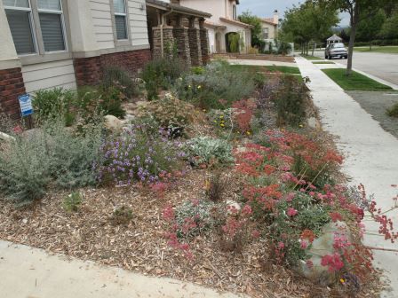
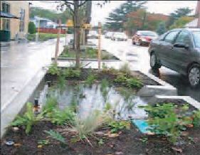
the roof and the rain gutters direct the water into sunken channels of the rain garden and
it should then go into the aquifer. The next picture is of the rain garden when it is more mature
in the spring time.
It is mainly used to capture water so it does not go into the sewers, then to the L.A. River and into the ocean unpurified. Some of that water is watering the plants. Healthy soil helps biologically treat pollutants before the water is infiltrated into the ground. This water capture concept is especially good in areas prone to flooding.
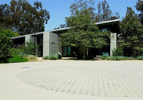
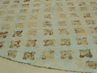
Besides roads, parking lots and sidewalks are some of the major reasons we have so little rain water seeping into our underground aquifers. It is important to change the way we build parking lots. Below are some ideas on what to do
(These 2 pictures from The River Project website)
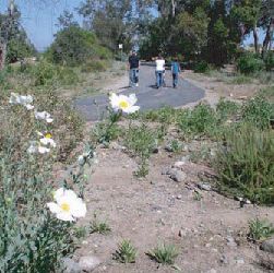
Trail of Decomposed granite (permeable A type of permeable paving
for water)
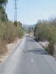
Pacoima Wash Recreation Trail with native plants
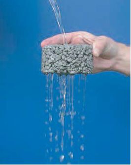
This is a demonstration of a type of permeable pavement at the TreePeople headquarters.
Photos by Gayle Dufour
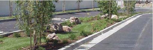
Demonstrate methods of cleaning and infiltrating stormwater along four major
roadways, increase absorbable surface area on major roads by improving or creating
medians with curb-cuts and installing pervious gutters for water quality
improvements, groundwater recharge, and flood protection. Provides incidental
`1habitat and expands urban forest cover.